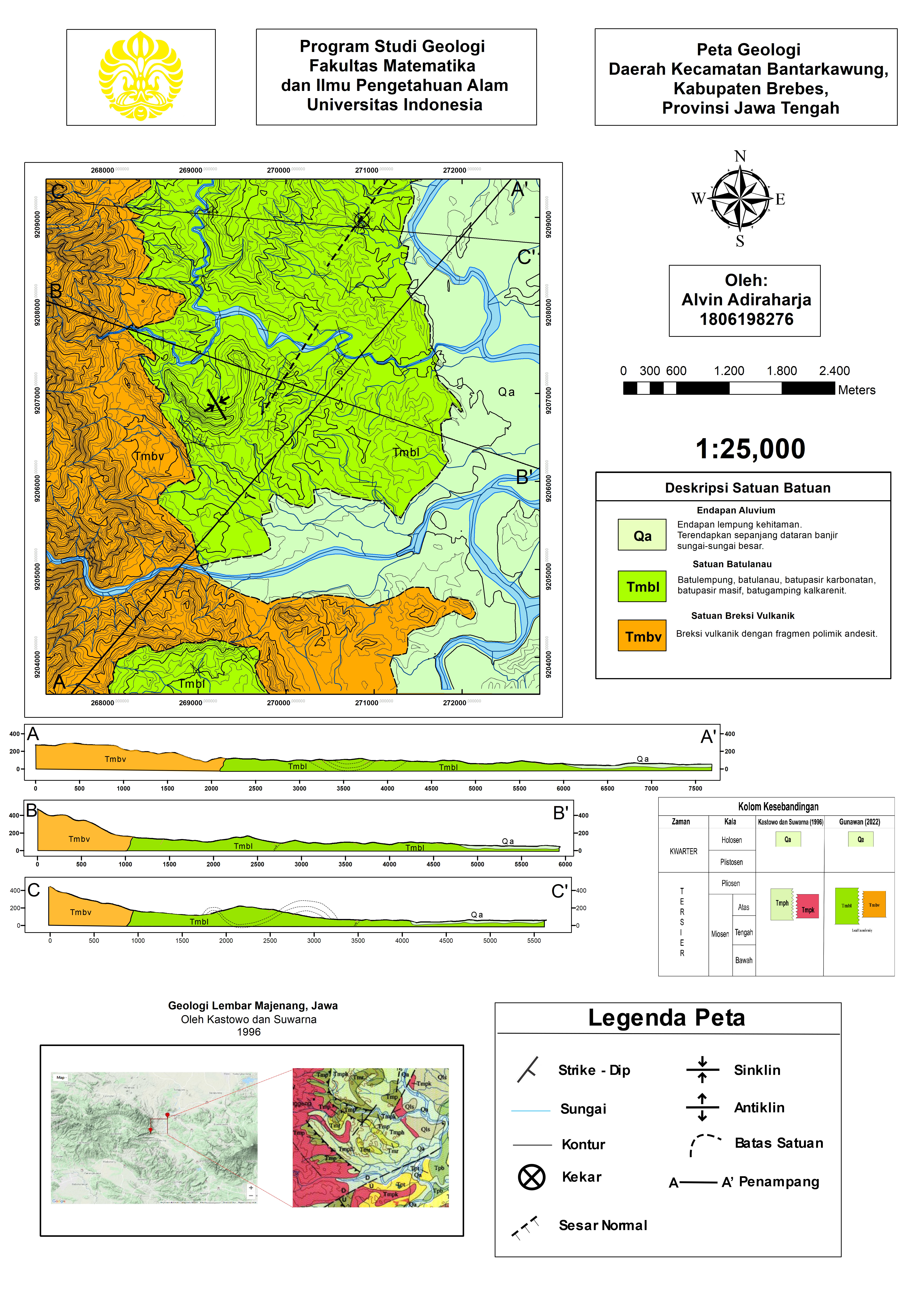
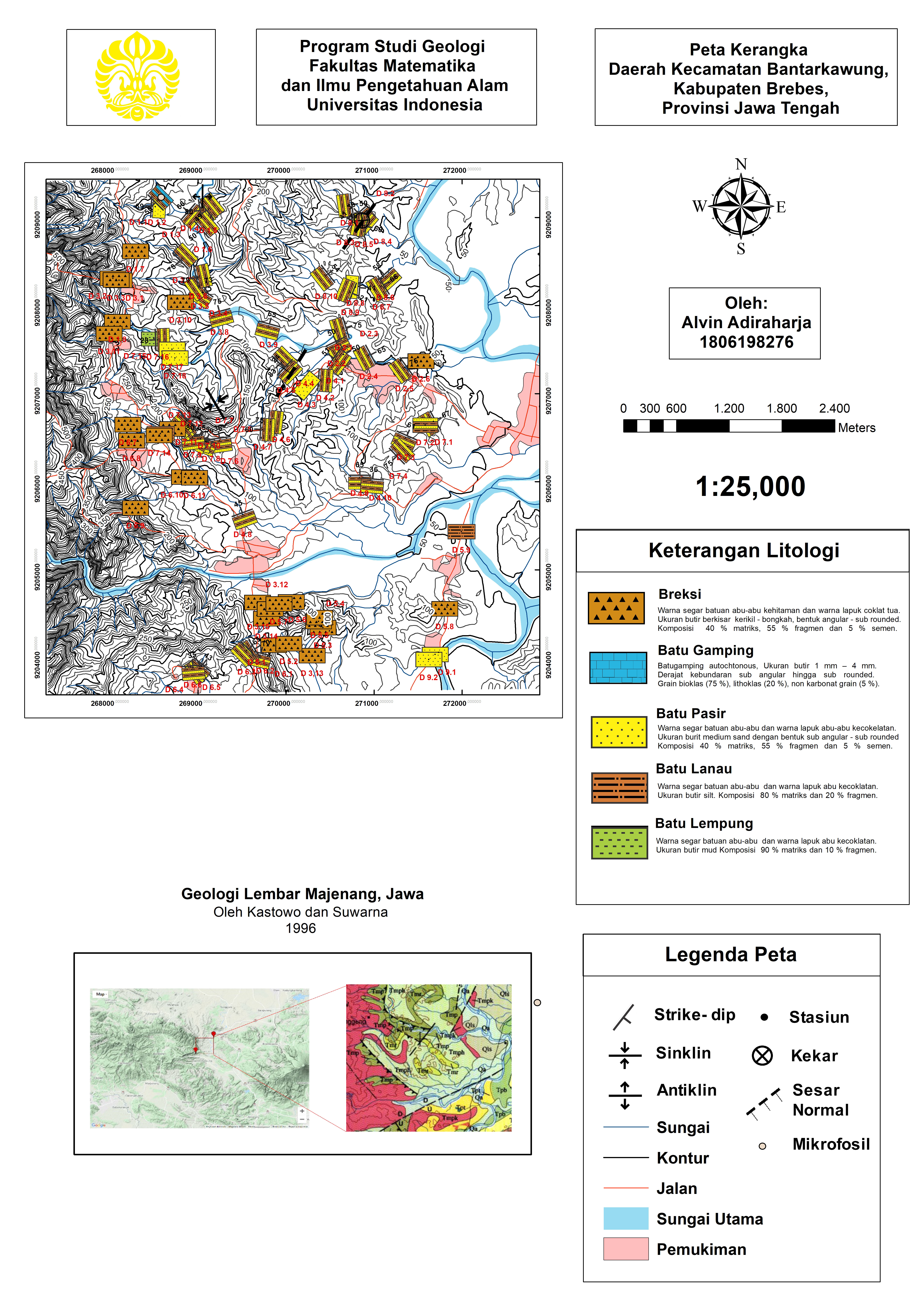
GIS Specialist & Geologist
Alvin
Adiraharja
Marcelino
Gunawan
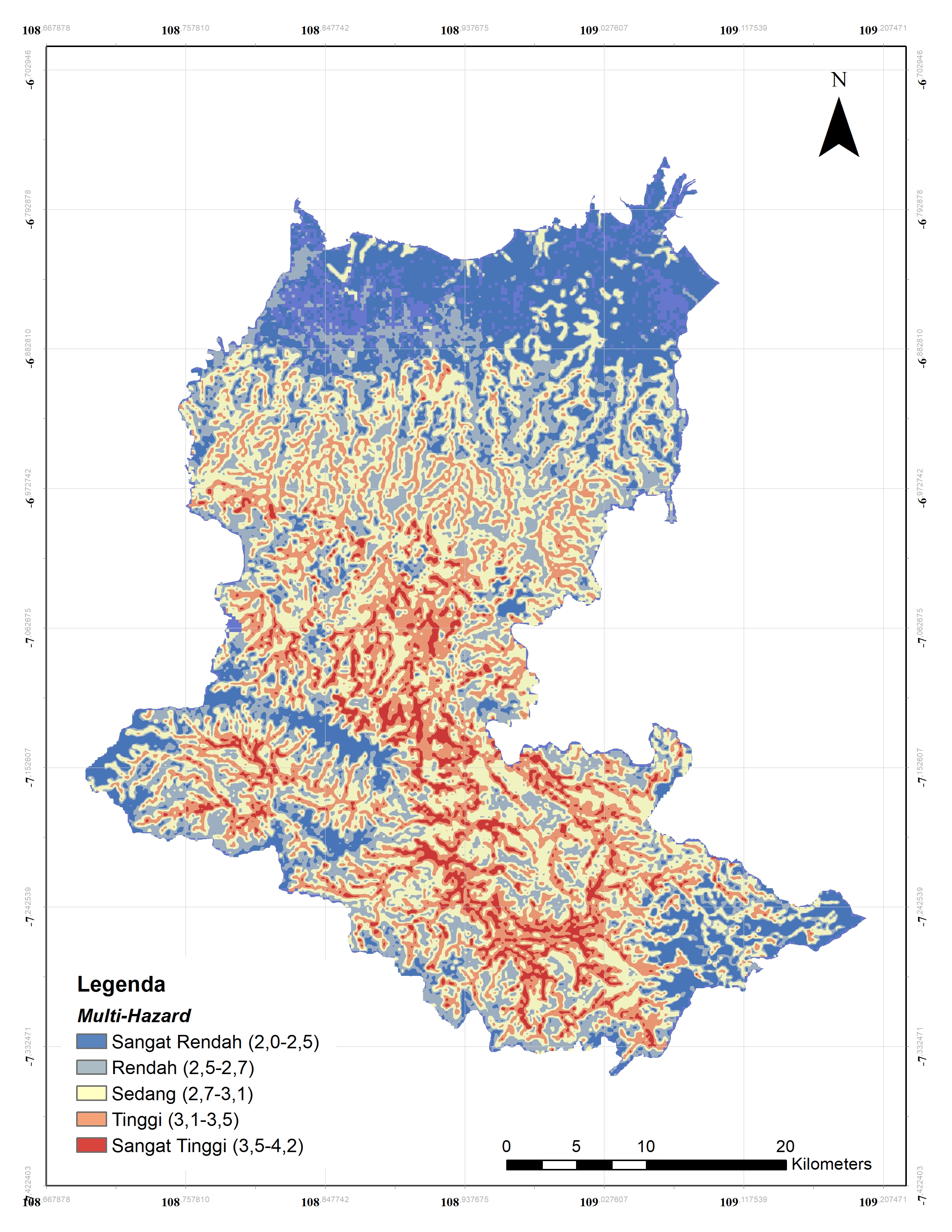
Spatial intelligence meets geological expertise. I build maps, analyze hazard risks, and turn complex geographic data into decisions.

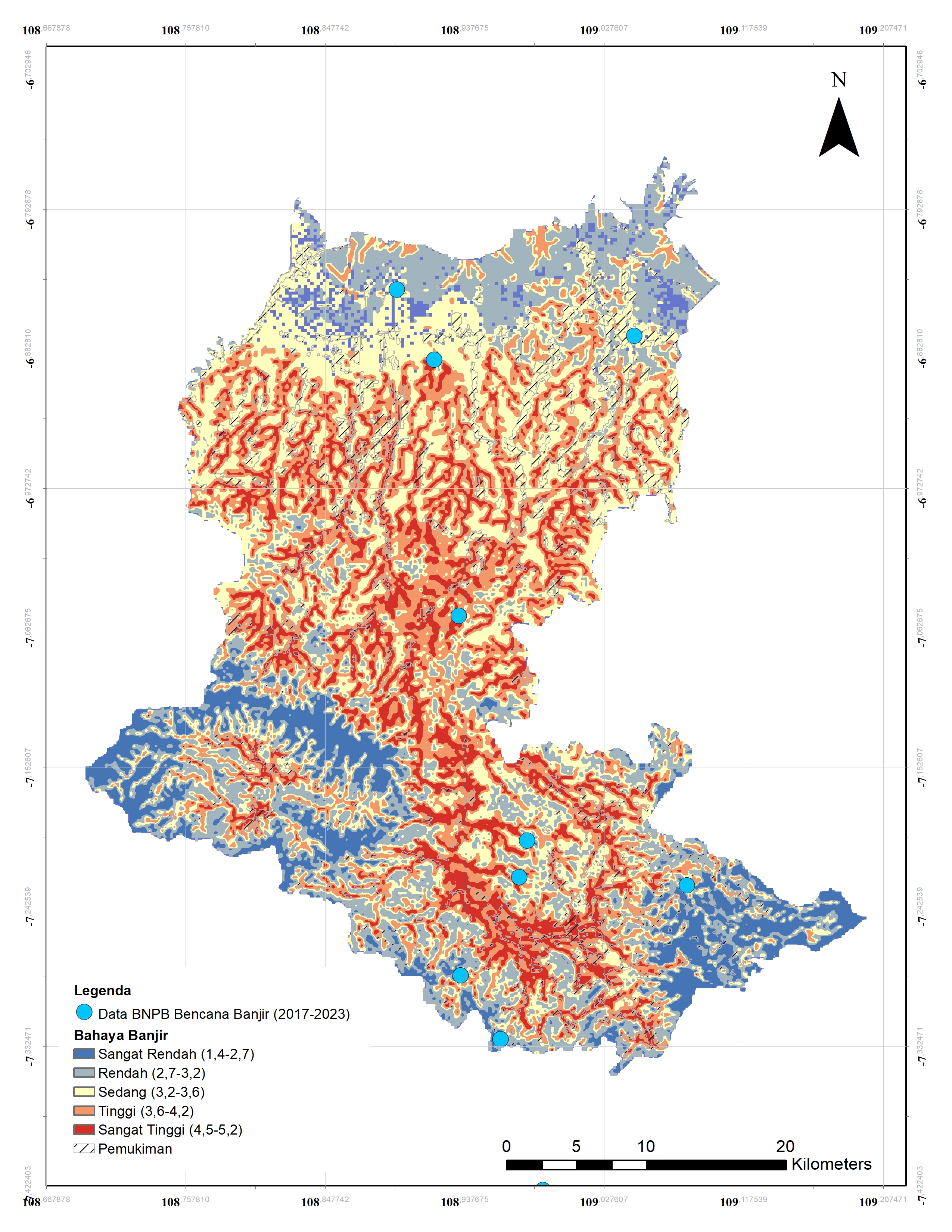
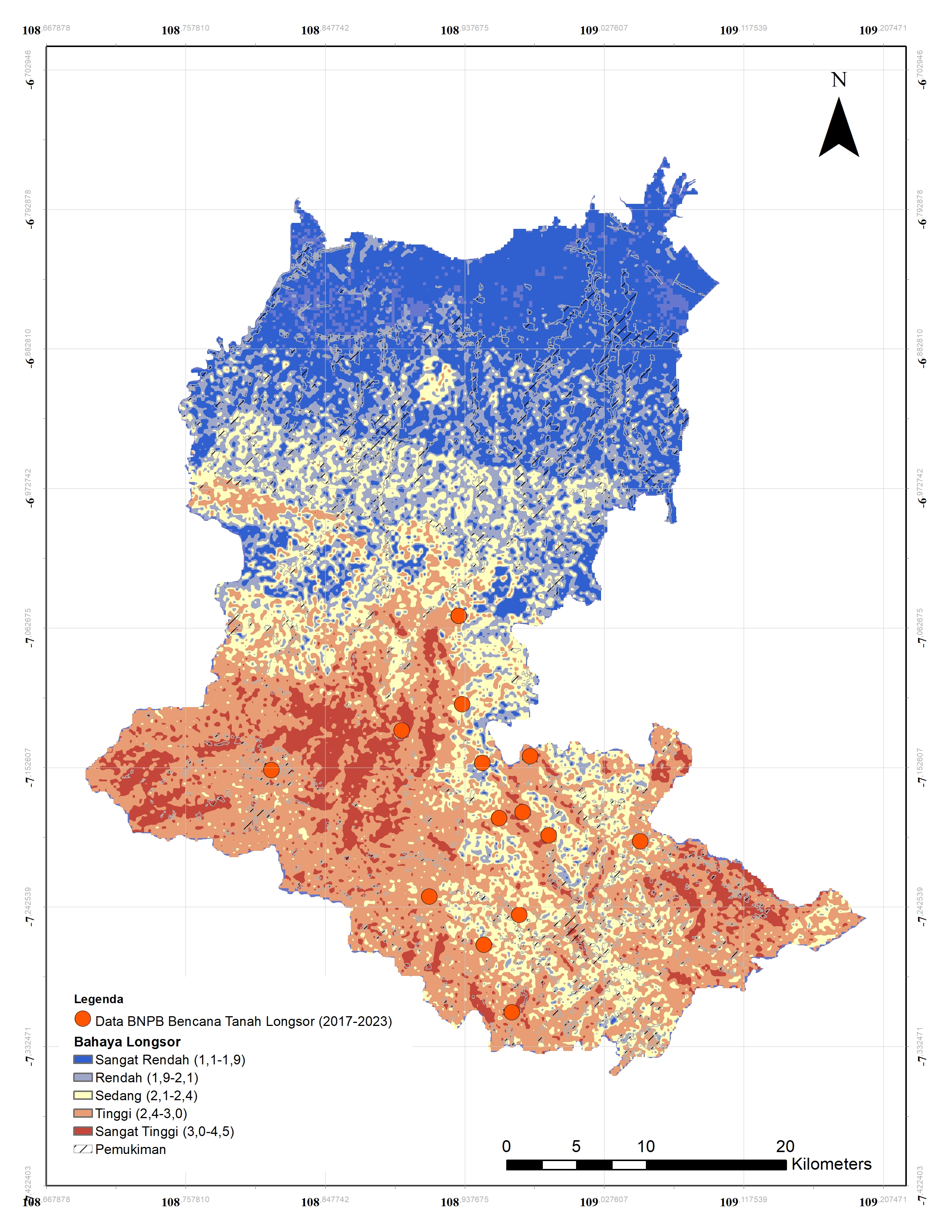
GIS
Technology
AHP
Method
3+
Map Types
GEO
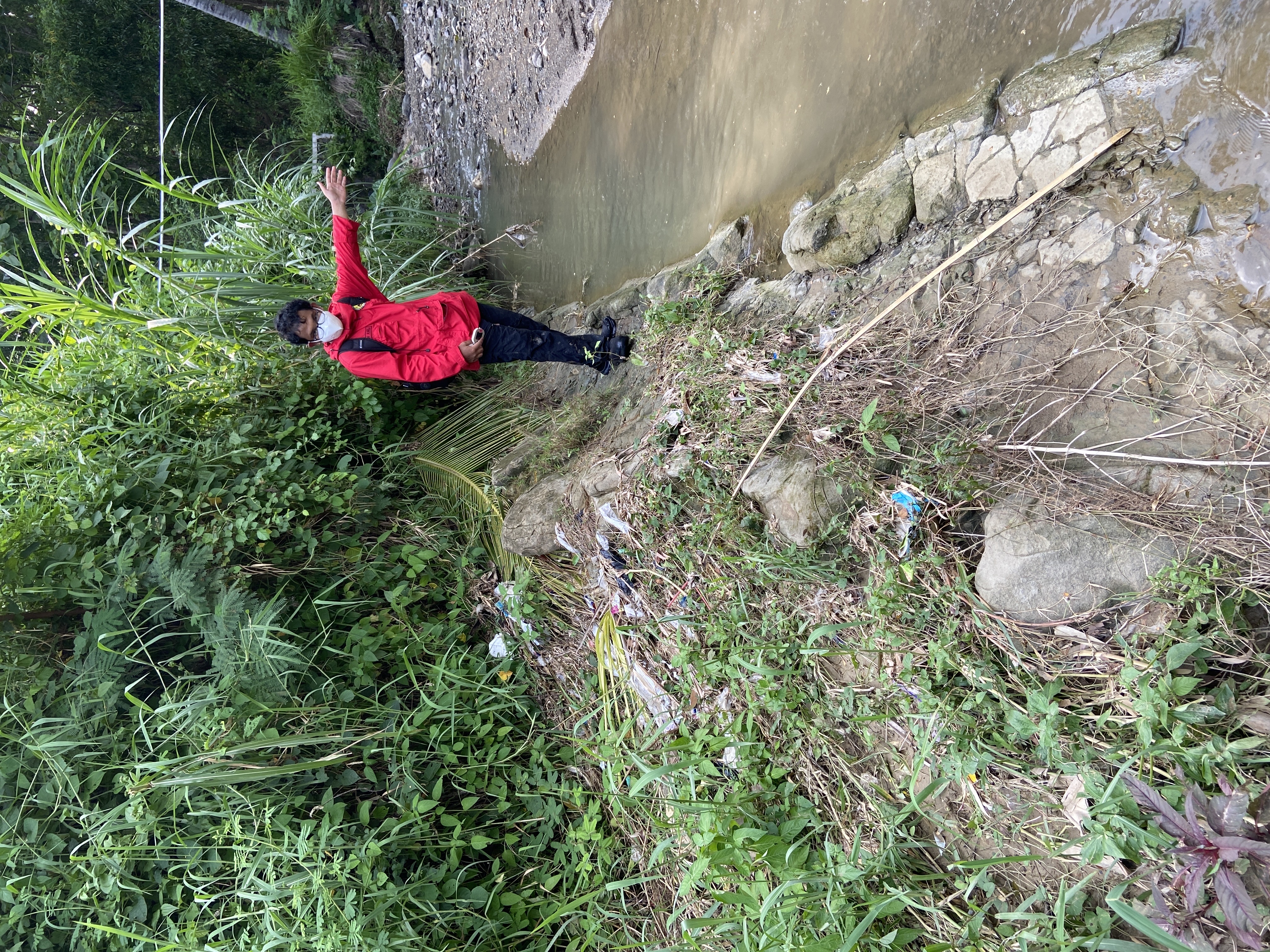
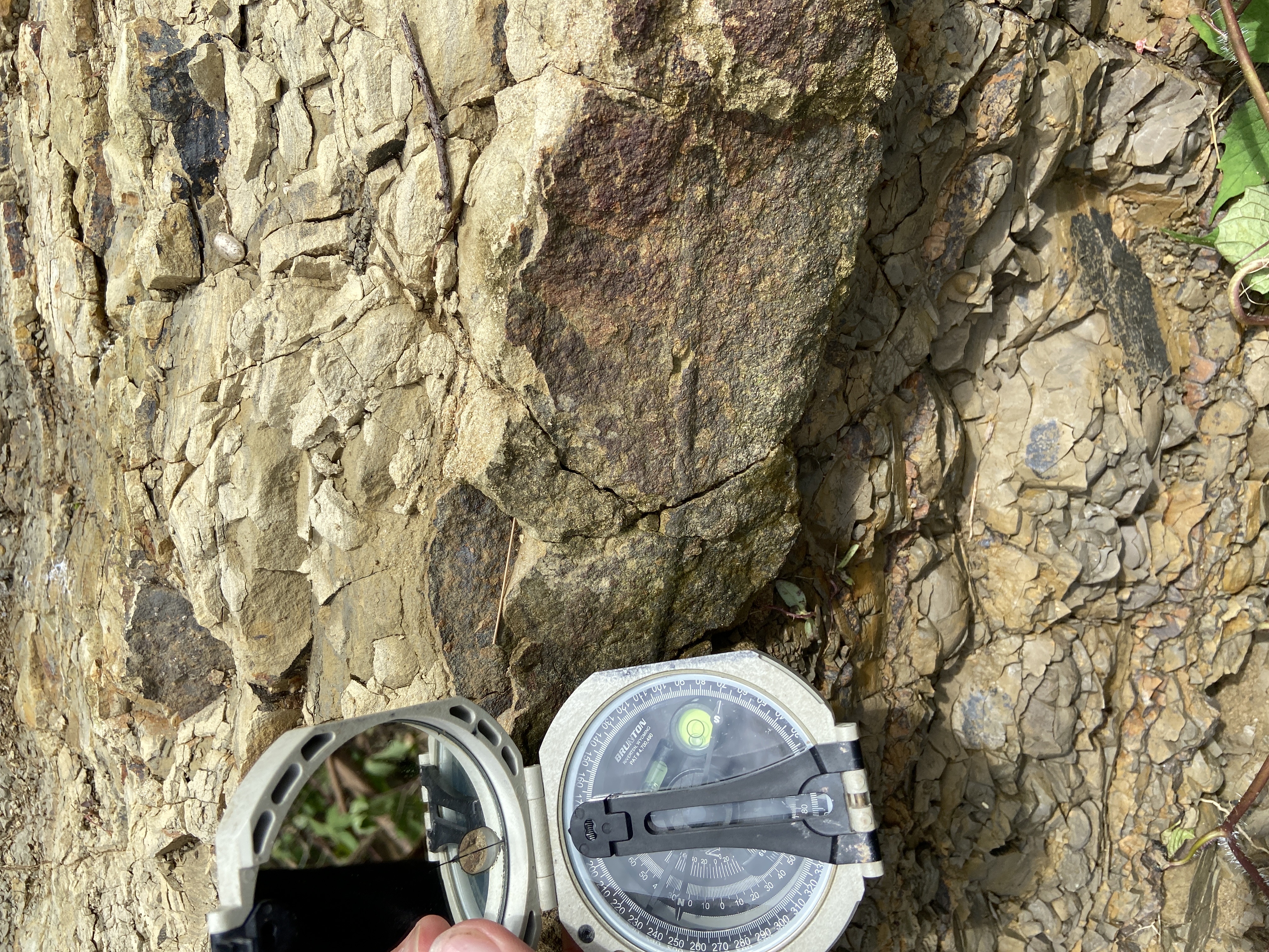
Field Work